- Home
- |
- Members
- |
- Membership Info
- |
- Contact Us
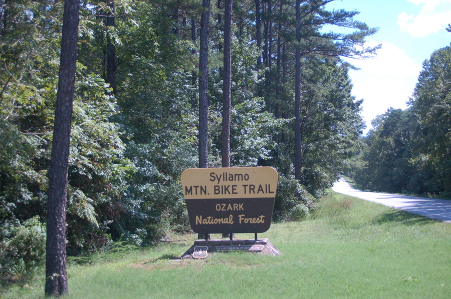
Hiking and Biking Trails
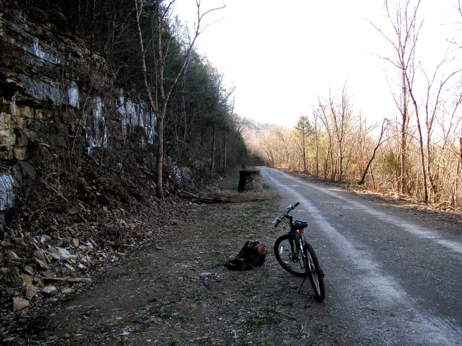
Getting out and into the thick of it is what its all about for some and often the fun of whats out there can be found by walking or riding a bike vs driving or by boat although all modes of transportation work around our parts. Just inside the City of Cotter at Big spring park is one of the first places to stop for a casual and leisurely stroll along the river banks with a 2.2 mile trail that can get you away from it all. Enjoy a bike ride along the flat route or take a stroll with the kiddos and see the historic Rainbow Arch Bridge and the Cotter Railroad Bridge while you explore.
Throughout the Ozarks and Arkansas, there are plenty of hiking and biking trails littered throughout the state that will allow you to veer off the beaten path if you wish. To learn more about where these trails are, see the links provided below.
Hiking and Biking Trails Plus Scenic Areas
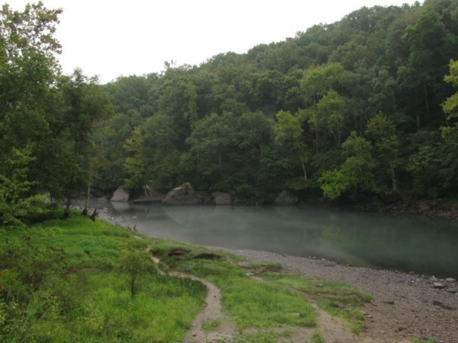
- Big Bluff Trail ~ Overlooking the White River and Bull Shoals Lake, the 1.75 mile loop trail is rated easy and has an average time of 2 hours to complete.
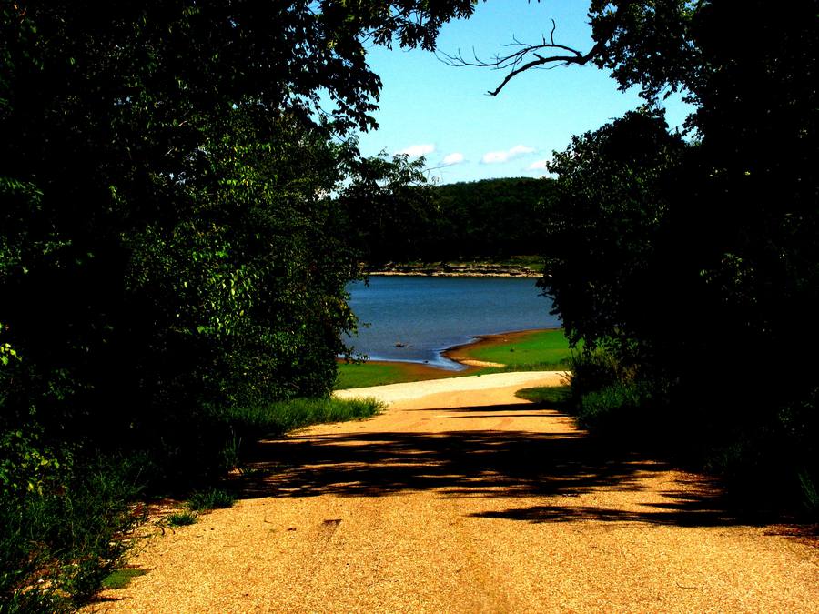
- Big Spring Park Trail ~ Running along the Eastern bank of the White River out of Cotter, this quiet and peaceful 2.75 mile trail is very easy but doesn't loop so choose how long you would like to hike for.
- Bull Shoals Lake ~ Bull Shoals Lake spans nearly 46,000 miles and offers plenty of swimming boating and extremely scenic: overlooks, roads, parks and hiking opportunities.
- Dogwood Trail ~ Dogwood Trail oversees Bull Shoals Lake and is in Lakeview AR. The moderate trail has a total length of 2.9 miles and is an out and back trail with minimal elevation.
- Indian Rockhouse Self Guided Nature Trail ~ The strenuous 3-5 mile hike takes you to the beautiful Indian Rockhouse Cave which once housed Native Americans that lived among the bluffs.
- Lakeside Trail ~ This short 1 mile loop trail that overlooks Bull Shoals Lake is located in Flippin AR and is open year round.
- Norfork Lake ~ Norfork Lake is another fantastic lake near Cotter and Gassville. Located just Southeast of both towns, this 22,000 mile lake is perfect for all things fun in or around water.
- Robinson Point Trail ~ This moderate to difficult 3.3 mile trail takes roughly 3.5 hours and follows the shores and bluffs of Norfork Lake.
- Rush mountain Trail ~ This Moderate to Strenuous .5 mile looped trail visits the old 1880's zinc ore mines and is located near the old town of Rush, a must see!
- Tyler Bend Trail System ~ A series of looped trails on the Buffalor River, these trails cover approximately 5.9 miles and consists of easy to moderately strenuous trails but spectacular views.